Otago Central Rail Trail
WalkOtago
- Grade
- Easy
- Distance
- 150 km
- Dogs
- Under control
Getting there
We have not checked a road end or car park for this place yet, so we do not give driving directions to it. Check how to get there before you go. Some routes cross private land and need the landowner's permission.
How to get there, on doc.govt.nzMap
Map data © OpenStreetMap contributors. Topo map: LINZ, CC BY 4.0. 45.17696° S, 169.90780° E
About this place
Pedalling Otago’s rural heart. The famous Rail Trail takes you through traditional country towns and sheep-farming land farmed by families for many generations.
The route
About the trail
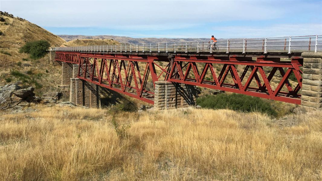
The 3-4 day Otago Central Rail Trail is a unique recreational experience, following the former Otago Central Branch Railway for 150 km from Middlemarch to Clyde. The rail trail is very popular and used annually by thousands of cyclists and walkers from around the world. It was developed by DOC in partnership with the Otago Central Rail Trail Trust for walkers, cyclists and horse riders. Since the closure of the railway in 1990, more than 60 bridges have been redecked and have had hand rails added to make them safe for trail users. The crushed rock ballast of the railway foundation has also been removed and replaced with gravel to improve the surface. The Otago Rail Trail joined Nga Haerenga, New Zealand Cycle Trail in March 2012.
Where to stay
On the trail there are two basic camping areas with toilets. One is between Daisybank and Tiroiti, the second is between Waipiata and Kokonga. Non-DOC camping grounds are located in Middlemarch, Ranfurly, Omakau, Alexandra, and Clyde. Other accommodation (hotels, backpackers) is available in Middlemarch, Waipiata, Ranfurly, Wedderburn, Lauder, Omakau, Ophir, Alexandra, and Clyde. The Otago Central Rail Trail website has a list of accommodation options.
Source: DOC Te Papa Atawhai.
Know before you go
What to expect
The track The rail trail is similar to riding or walking on a reasonably level gravel road or track, as the gradient rarely exceeds 1 in 50. The trail surface is gravel, so you can expect some bumps and loose material. The track is wide enough to allow for side-by-side riding. Walkers, cyclists, dogs and horses all share the track, so take care and respect other users. Weather The trail gets very hot in summer and temperatures can reach 30 degrees Celsius. Sections of the track are exposed with little shelter, so pack sun protection and plenty of water. In winter, temperatures can be cold with frosty mornings. Strong winds can happen at any time of year and make biking much harder. Services Some sections of the track have limited services – plan your stops accordingly. There are no shops or accommodation between Hyde and Middlemarch. The trail mainly has cell phone coverage but there are some sections that have patchy or no reception.
Experience and fitness you need
The Otago Central Rail Trail is graded as Easy: Grade 2 and is a good choice for families or less experienced mountain bikers. However, be aware that the trail is 152 km, which is a long way and means 4-5 hours a day on a bike. For this reason, pre-trip training on rougher ground is a good idea. You will have a much more enjoyable experience when you do the trail. Average walking speed is 4-6 km/hr and for cyclists it's 10-12 km/hr. Most cyclists cover the 152 km over 3–4 days and walkers can take up to a week. There are shorter and day ride alternatives to the full trail. Many people do several sections over a period of time – kids of all ages will love the tunnels and viaducts on the Lauder to Auripo section.
Plan and prepare for your trip
Be ready for all weather by packing plenty of water, sun protection, and warm, waterproof and windproof clothing. You will need a hybrid or mountain bike and remember a torch for the tunnels. You can plan your trip and find packing lists on the Otago Central Rail Trail website .
Source: DOC Te Papa Atawhai.
Notes from people who have been
No notes yet. If you have been, say what you found.
Something missing or out of date?
Closed, moved, wrong facts, or something we have missed? Travellers keep the Road Guide up to date. Tell us what you found at contribute@parkup.nz and we will check it and add it.
Ask us to take this down
A person reads every request. We do not remove a place until we have checked it.
Sources
- DOC Tracks (API) · CC BY 4.0Crown Copyright: Department of Conservation Te Papa Atawhai. Data sourced from the DOC Developer Portal (api.doc.govt.nz).