Ngatoro Loop Track
WalkTaranakiOpen
- Grade
- Advanced
- Walking time
- 1 hr
- Distance
- 1.2 km
- Route
- Loop
- Dogs
- No dogs
Getting there
We have not checked a road end or car park for this place yet, so we do not give driving directions to it. Check how to get there before you go. Some routes cross private land and need the landowner's permission.
How to get there, on doc.govt.nzThe track starts at the North Taranaki Visitor Centre.
To get there, head 13 km south from New Plymouth to Egmont Village. Turn off State Highway 3 on to Egmont Road and follow it for 16 km to the end. The visitor centre is signposted from the junction.
Source: DOC Te Papa Atawhai.
Map
Map data © OpenStreetMap contributors. Topo map: LINZ, CC BY 4.0. 39.27193° S, 174.09585° E
Got a good photo of this place? Send it to us and we will show it with your name.
About this place
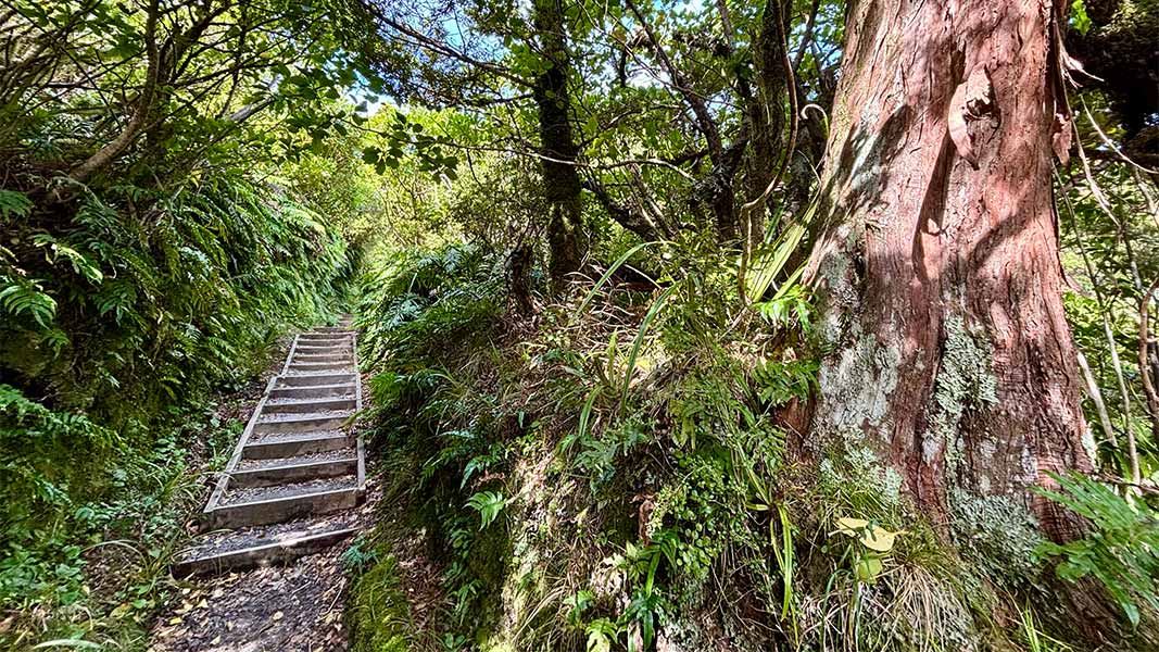
A short loop on a tramping track through dense forest coated in ferns and moss.
The route
From the visitor centre, follow the boardwalk to the viewing platform past the Camphouse and onto the Summit Track. The Ngatoro Loop Track starts 400 metres along from here. The track descends into a valley through ‘goblin forest’ where ferns and moss hang from twisted tree trunks. It crosses a small stream and then steps return you to the visitor centre.
Source: DOC Te Papa Atawhai.
Know before you go
Stream crossing
There is an unbridged stream crossing which (although usually dry) can become impassable after heavy rain.
Be prepared for changeable weather
Weather on the mountain changes rapidly – you must be well prepared with suitable clothing and equipment for all weather and conditions. Snow, high rainfall and storm damage can make tracks impassable – many rivers and streams are unbridged. Check the Te Papa-Kura-o-Taranaki weather forecast before you go.
Source: DOC Te Papa Atawhai.
Nearby stops
The Camphouse
Taranaki • 0.2 km
The Camphouse is a historic hut situated on the slopes of Mount Taranaki in the Taranaki region. It serves as a base for exploring the walking tracks within…

Maketawa Hut
Serviced • 16 bunks • Taranaki • 1.1 km
Maketawa Hut is a DOC hut in the Taranaki region suitable for experienced trampers. It offers views of Taranaki Maunga from the deck.
Heating • Mattresses • Toilets - non-flush
Tahurangi Lodge
26 bunks • Taranaki • 2.2 km
Tahurangi Lodge is a hut located in the Taranaki region of New Zealand. The provided data does not contain further details regarding its specific facilities or…
Five Dollar Hut
Taranaki • 3.5 km
Five Dollar Hut is a basic shelter located in the Taranaki region. The provided records do not list specific facilities or details for this hut.
Manganui Public Shelter
Taranaki • 3.6 km
Walks nearby
Notes from people who have been
No notes yet. If you have been, say what you found.
Something missing or out of date?
Closed, moved, wrong facts, or something we have missed? Travellers keep the Road Guide up to date. Tell us what you found at contribute@parkup.nz and we will check it and add it.
Ask us to take this down
A person reads every request. We do not remove a place until we have checked it.
Sources
- DOC Tracks & Trails · CC BY 4.0Data sourced from the Department of Conservation (DOC), New Zealand.
- DOC Tracks (API) · CC BY 4.0Crown Copyright: Department of Conservation Te Papa Atawhai. Data sourced from the DOC Developer Portal (api.doc.govt.nz).
- OpenStreetMap Trails · ODbL (Open Database License)Contains information from OpenStreetMap, made available under the ODbL.