Mt Nimrod Track
WalkCanterburyOpen
- Grade
- Advanced
- Walking time
- 3 hr
- Distance
- 3 km
- Route
- Loop
- Dogs
- No dogs
Getting there
We have not checked a road end or car park for this place yet, so we do not give driving directions to it. Check how to get there before you go. Some routes cross private land and need the landowner's permission.
How to get there, on doc.govt.nzMt Nimrod Scenic Reserve is on the eastern side of The Hunters Hills. It is 32 km southwest of Tīmaru and 43 km northwest of Waimate. The reserve is spread over the deep and spectacular gorges of Nimrod Stream and White Rock River.
From Tīmaru follow State Highway 1 south for approximately 10 km. Turn right onto Pareora River Road and follow for 16 km past the Pareora Hut settlement onto Pareora Gorge Road. After 5 km turn left onto Limestone Road, then onto Motukaika Road. Follow for 11 km then turn right at the T-junction onto Back Line Road. After 2 km, turn left into Mt Nimrod Road. Follow the DOC signs and carry straight on into the reserve. Do not turn left as it is a private driveway for Mt Nimrod farm.
Source: DOC Te Papa Atawhai.
Map
Map data © OpenStreetMap contributors. Topo map: LINZ, CC BY 4.0. 44.43516° S, 170.86481° E
About this place
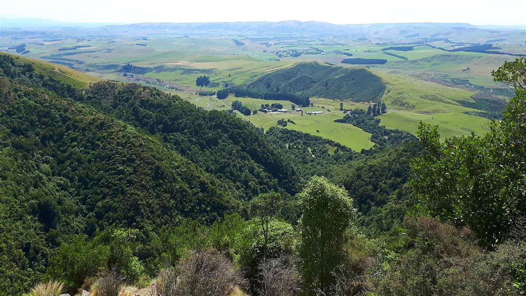
Walk to a cascading waterfall and enjoy gorgeous views out to the coast.
The route
This track has great views and a waterfall that plummets through a rock arch. From the campground, take the bridge across Nimrod Stream where the loop track takes you on an anti-clockwise circuit of the reserve. Initially it climbs steeply up out of the forest to a lookout point which gives good views out to the coast. The track then drops sharply down to Nimrod Stream which has to be forded. A short detour upstream (watch out for slippery rocks) takes you to a pretty 15 m waterfall cascading through a small rock arch. From here the track climbs again to rocky knolls with great views out over the reserve to the coast. The track then drops back through the forest to the car park.
Source: DOC Te Papa Atawhai.
Nearby stops

Mt Nimrod Campsite
Standard • Canterbury • 0.5 km
Mt Nimrod Campsite is a quiet campsite located on the eastern flank of the Hunter Hills in Canterbury. A 3.5 km forest walk leads from the site to a podocarp…
Fire pit/place for campfires (except in fire bans) • Non-powered/tent sites • Water from tap - not treated, boil before use

Otaio Gorge Campsite
Standard • Canterbury • 11.1 km
Otaio Gorge Campsite is a campsite located in Canterbury. It is situated within a scenic reserve beside the forest, offering the opportunity to swim in the…
Fire pit/place for campfires (except in fire bans) • Non-powered/tent sites • Toilets - flush
Notes from people who have been
No notes yet. If you have been, say what you found.
Something missing or out of date?
Closed, moved, wrong facts, or something we have missed? Travellers keep the Road Guide up to date. Tell us what you found at contribute@parkup.nz and we will check it and add it.
Ask us to take this down
A person reads every request. We do not remove a place until we have checked it.
Sources
- DOC Tracks (API) · CC BY 4.0Crown Copyright: Department of Conservation Te Papa Atawhai. Data sourced from the DOC Developer Portal (api.doc.govt.nz).
- DOC Tracks & Trails · CC BY 4.0Data sourced from the Department of Conservation (DOC), New Zealand.