Mt Isobel Track
WalkCanterburyOpen
- Grade
- Advanced
- Walking time
- 6 hr
- Dogs
- Under control
Getting there
We have not checked a road end or car park for this place yet, so we do not give driving directions to it. Check how to get there before you go. Some routes cross private land and need the landowner's permission.
How to get there, on doc.govt.nzHanmer Springs, at an altitude of 385 metres, is 135 kilometres north of Christchurch, off Lewis Pass Highway.
Source: DOC Te Papa Atawhai.
Map
Map data © OpenStreetMap contributors. Topo map: LINZ, CC BY 4.0. 42.49300° S, 172.83563° E
About this place
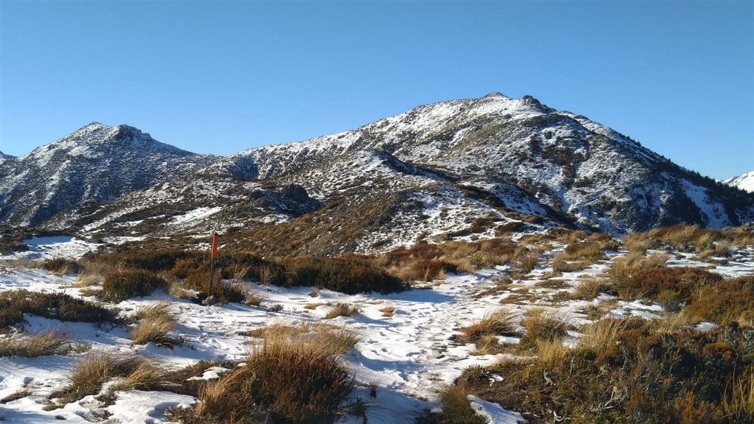
This is the most popular route to Mt Isobel Summit.
The route
The track from Clarence Valley Road is the most popular track to the summit. Begin at Clarence Valley Road car park and journey through European and Japanese larches before entering subalpine scrub and open grassland. The track makes its way through the forested lower slopes before emerging above the tree line. Above the treeline you enter sub-alpine terrain. There are rocky sections and the temperature can drop. Be prepared with hiking boots and warm layers. Continue to the summit of Mt Isobel (1324 m) for wide open views of Hanmer Basin and beyond. The summit is marked with a trig marker. This walk is best suited to experienced, fit, trampers. The track is exposed at the tops. Pack warm clothes. Snow can cover the summit during winter.
Source: DOC Te Papa Atawhai.
Nearby stops
Hanmer Amenity Area
Canterbury • 2.3 km
Hanmer Amenity Area is at the Hanmer Field Base and picnic area on Pawsons Road in Hanmer Springs. Freedom camping is limited to self-contained vehicles for up…
Pines Holiday Park
Canterbury • 3.2 km
Hanmer Springs Forest Camp
Canterbury • 3.3 km
Hanmer Springs Forest Camp is a campsite located in the Canterbury region of New Zealand. The provided records do not list specific facilities or amenities for…
Alpine Holiday Apartments & Campground
Canterbury • 3.4 km
Mountain View Top 10 Holiday Park
Canterbury • 3.9 km
Walks nearby
Waterfall Track
Easy • 1 hr 30 min one way • 2.1 km • 0.56 km away
Jacks Pass Track to Mt Isobel
Advanced • 4-5 hr return • 6.4 km return • 1.42 km away
Jolliffe Saddle Track
Easy • 850 m • 1.66 km away
Jollies Pass Track to Mt Isobel
Advanced • 4-5hr return • 6 km return • 2.54 km away
Woodlands Walk
Easiest • 1 hr return • 2.64 km away
Notes from people who have been
No notes yet. If you have been, say what you found.
Something missing or out of date?
Closed, moved, wrong facts, or something we have missed? Travellers keep the Road Guide up to date. Tell us what you found at contribute@parkup.nz and we will check it and add it.
Ask us to take this down
A person reads every request. We do not remove a place until we have checked it.
Sources
- DOC Tracks & Trails · CC BY 4.0Data sourced from the Department of Conservation (DOC), New Zealand.
- DOC Tracks (API) · CC BY 4.0Crown Copyright: Department of Conservation Te Papa Atawhai. Data sourced from the DOC Developer Portal (api.doc.govt.nz).