Mount Adams Route
WalkWest Coast
- Grade
- Expert
- Walking time
- 2 days
- Dogs
- DOC permit only
Getting there
We have not checked a road end or car park for this place yet, so we do not give driving directions to it. Check how to get there before you go. Some routes cross private land and need the landowner's permission.
How to get there, on doc.govt.nzAccess to the Mt Adams Route is approximately 10 km north of Whataroa on the northern side of the Little Man River (Dry Creek) bridge. A short farm track leads off State Highway 6 in towards the mountains and your vehicle can be parked near the first gate (be careful not to block the farm access).
Source: DOC Te Papa Atawhai.
Map
Map data © OpenStreetMap contributors. Topo map: LINZ, CC BY 4.0. 43.24475° S, 170.46426° E
About this place
Mount Adams sits proudly on the edge of the Adams Wilderness Area in the Southern Alps/Kā Tiritiri o te Moana, and is a focal point for travellers along State Highway 6 from Lake Ianthe to Lake Wahapo.
The route
At 2208 m high, the summit provides commanding views across the alps, Adams Wilderness Area, the coastline and the flats in between. The route from Little Man River (Dry Creek) up to the bush edge on Mt Adams was re-opened in 2009. The route is well marked and windfalls are cleared every two years.
State Highway 6 – bush edge
Time: 5 hr
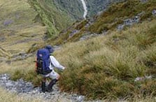
Follow the farm track upstream for approximately 1 km before dropping down into the riverbed. The route, while mainly on the true right, may change because of storms and floods. You will have to pick the best places to cross the river, and re-cross if required. The valley soon becomes confined by steep hillsides and after approximately 2 hours you will reach the second major tributary joining the main river on the true right. At this point the main river cuts sharply back on itself and into a tight gorge. Look for the large orange triangle marking the route entrance into the forest on the true right, around 50 m up from the confluence. This is the last creek so make sure you have enough water with you to last until you reach the snowline and beyond. The route climbs very steeply up tree-root-covered ground to the crest of a spur about 20 min into the forest. As you continue to climb the forest becomes more stunted and eventually you are moving through subalpine scrub. After climbing steadily for approximately 3 hours you will pop out onto a sloping tussock-covered ridgeline. Further up the ridge there are several good locations to camp – between approximately 1545 m and 2100 m. Warning: The marked route ends just past the bush line at the two yellow and orange deer posts. Travel beyond this point is suitable only for mountaineers and those experienced in alpine travel. You must take a map, compass and alpine equipment, and know how to use them.
Source: DOC Te Papa Atawhai.
Know before you go
Stay safe when crossing rivers and streams
If you plan to cross unbridged rivers or side streams, know how to cross safely and be prepared for if you cannot cross. Do not cross if the river or stream is flooded, you cannot find safe entry and exit points or are unsure it’s safe. Turn back or wait for the river to drop. If in doubt, stay out. How to cross rivers safely NIWA river flow forecasts: View a video of national followed by regional river flows Best seasons Summer and autumn Maps NZTopo50: BW16 Whataroa, BW17 Harihari Hazards Flooded rivers, rockfall and avalanche. This trip should not be attempted when it is raining, rain is forecast or the river is running high. If you are travelling beyond the snowline then make sure you check avalanche conditions, are sufficiently equipped and experienced to assess the conditions and choose a safe path through avalanche terrain.
Source: DOC Te Papa Atawhai.
Nearby stops

Nolans Hut
Basic/bivvies • 4 bunks • West Coast • 11.7 km
Nolans Hut is a basic four-bunk hut located in the Glaciers area of the West Coast.
Heating • Mattresses • Toilets - non-flush
Whataroa Gorge Freedom Camping
West Coast • 11.7 km
This freedom camping area on the West Coast is managed by the Westland District Council and is free for both self-contained and non-self-contained campers. The…
Hotel Hari Hari Campground
West Coast • 13.2 km
Hotel Hari Hari Campground is a campsite located on the West Coast of New Zealand. The provided records do not list specific facilities or details for this…
Stan's Hut
Standard • 4 bunks • West Coast • 13.3 km
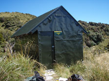
Stan's Hut is a standard four-bunk hut located in the Glaciers area of the West Coast.
Mattresses • Toilets - non-flush • Water from stream

Scone Hut
Standard • 6 bunks • West Coast • 16.9 km
Scone Hut is a standard six-bunk hut located in the Glaciers area of the West Coast.
Heating • Mattresses • Toilets - non-flush
Walks nearby
Notes from people who have been
No notes yet. If you have been, say what you found.
Something missing or out of date?
Closed, moved, wrong facts, or something we have missed? Travellers keep the Road Guide up to date. Tell us what you found at contribute@parkup.nz and we will check it and add it.
Ask us to take this down
A person reads every request. We do not remove a place until we have checked it.
Sources
- DOC Tracks (API) · CC BY 4.0Crown Copyright: Department of Conservation Te Papa Atawhai. Data sourced from the DOC Developer Portal (api.doc.govt.nz).