Minaret Burn Track
WalkOtagoOpen
- Grade
- Advanced
- Distance
- 45 km
- Route
- Return
- Dogs
- No dogs
Getting there
We have not checked a road end or car park for this place yet, so we do not give driving directions to it. Check how to get there before you go. Some routes cross private land and need the landowner's permission.
How to get there, on doc.govt.nzThe track starts at Homestead Bay, at the end of West Wanaka Road.
Source: DOC Te Papa Atawhai.
Map
Map data © OpenStreetMap contributors. Topo map: LINZ, CC BY 4.0. 44.54782° S, 169.04145° E
About this place
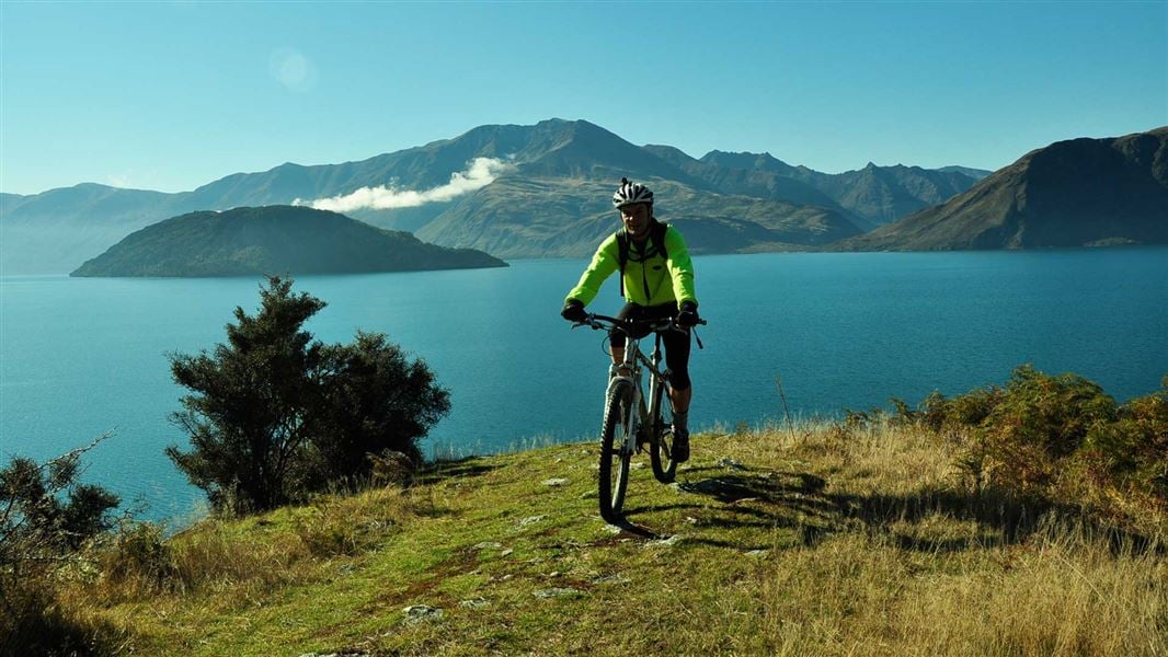
This walk passes through native forest and bush, crossing burns (streams) and giving access to Lake Wānaka itself. This track is suitable for walking, mountain biking and horse riding.
The route
Starting from the carpark at Homestead Bay, the track follows Lake Wānaka to Minaret Burn. From Homestead Bay, the walking track undulates gently above the Lake Wānaka shoreline until it meets a 4WD track. About 2 – 3 hours (7.5 km) from Homestead Bay a track leads off to the right to Colquhouns Beach, a pleasant place to swim and picnic. After crossing Station Creek, you’re in the conservation area of the same name and now following the Minaret Burn tramping track. This incorporates remnant forest and shrublands and provides access to the lake foreshore. On the main track, after about 10 minutes, it crosses the Rumbling Burn. Take care crossing this burn as it may be impassable during snowmelt or after heavy rain. By taking the track to cross the burn you’re in the Minaret Burn Mouth Conservation Area. From here the track climbs steeply out of Rumbling Burn Valley before following a gentle terrace to the Minaret Burn. It is a relatively easy walk up the valley. The burn’s true left is on Minaret Station and permission is required for access. This track is suitable for walking, mountain biking and horse riding. There are no horse gates. Riders must get access details and a gate key from West Wānaka Station (+64 27 329 3315) for locked gates on public tracks.
Side trip
Rumbling Burn Track 2.25 km one way from Minaret Burn junction At the far north end of Colquhouns Beach, before the hill climb, the Rumbling Burn Track leads off to the left. This track gives access (foot only) to the Mount Alta Conservation Area. It's an easy uphill sidle. At the mouth of the Rumbling Burn you’ll find a delightful bush-clad beach.
Source: DOC Te Papa Atawhai.
Know before you go
Be avalanche alert
Avalanches can occur in any season. Any time that snow and steep slopes are combined there is potential for an avalanche. You need to understand the risks before you visit avalanche-prone country. This area has terrain that can produce avalanches that cross the track, usually from May into November. View avalanche information and the terrain rating for this track .
Stay safe when crossing rivers and streams
If you plan to cross unbridged rivers or side streams, know how to cross safely and be prepared for if you cannot cross. Do not cross if the river or stream is flooded, you cannot find safe entry and exit points or are unsure it’s safe. Turn back or wait for the river to drop. If in doubt, stay out. How to cross rivers safely NIWA river flow forecasts: View a video of national followed by regional river flows
Source: DOC Te Papa Atawhai.
Nearby stops

Wānaka Faces Hut
Basic/bivvies • 2 bunks • Otago • 8.3 km
Wānaka Faces Hut is a basic hut located in the Wānaka area of Otago.
Mattresses • Toilets - non-flush • Water from stream
Glendhu Bay Holiday Park
Otago • 14.1 km
Glendhu Bay Holiday Park is a campsite located in the Otago region of New Zealand. The provided data does not list specific facilities or amenities for this…
Outlet Camp Wānaka
Otago • 15.8 km
Outlet Camp Wānaka is a campsite located in the Otago region. The provided records do not list specific facilities or details for this location.
Saddle Hut
Otago • 15.8 km
Saddle Hut is a hut located in the Otago region. The provided records do not include specific details regarding its facilities or access.
Albert Town Campground
Otago • 18.7 km
Albert Town Campground is a campsite located in the Otago region of New Zealand. The provided data does not include specific details regarding available…
Walks nearby
Notes from people who have been
No notes yet. If you have been, say what you found.
Something missing or out of date?
Closed, moved, wrong facts, or something we have missed? Travellers keep the Road Guide up to date. Tell us what you found at contribute@parkup.nz and we will check it and add it.
Ask us to take this down
A person reads every request. We do not remove a place until we have checked it.
Sources
- OpenStreetMap Trails · ODbL (Open Database License)Contains information from OpenStreetMap, made available under the ODbL.
- DOC Tracks (API) · CC BY 4.0Crown Copyright: Department of Conservation Te Papa Atawhai. Data sourced from the DOC Developer Portal (api.doc.govt.nz).
- DOC Tracks & Trails · CC BY 4.0Data sourced from the Department of Conservation (DOC), New Zealand.