McLean Falls Walk
WalkOtagoOpen
- Grade
- Easiest
- Walking time
- 40 min
- Distance
- 2.1 km
- Route
- Return
- Dogs
- On a lead
Getting there
We have not checked a road end or car park for this place yet, so we do not give driving directions to it. Check how to get there before you go. Some routes cross private land and need the landowner's permission.
How to get there, on doc.govt.nzTurn off Chaslands Highway onto Rewcastle Road 11.6 km south of Papatowai. It's a further 3 km to the car park.
The carpark is not suitable for large busses.
Source: DOC Te Papa Atawhai.
Map
Map data © OpenStreetMap contributors. Topo map: LINZ, CC BY 4.0. 46.57162° S, 169.34898° E
About this place
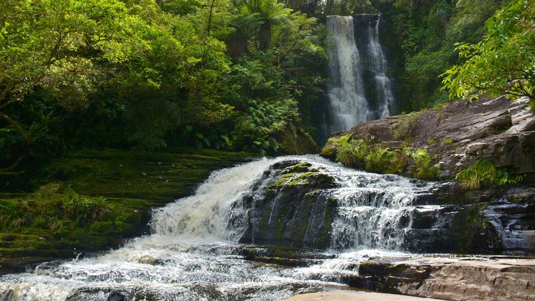
Walk to the spectacular McLean Falls though a variety of forest and shrub types.
The route
Once leaving the carpark you start your short journey through native bush that was once logged. The walk does go uphill slightly but it's still a gentle walk. The last part of the track has had a large slip – don't stop between the rock fall signs. The 22 metres tall waterfall is on the Tautuku river within the Catlins Conservation Park.
Source: DOC Te Papa Atawhai.
Nearby stops
The Whistling Frog Resort
Otago • 2.2 km

Tautuku Hut
Basic/bivvies • 4 bunks • Otago • 2.7 km
Tautuku Hut is a basic four-bunk hut located in the Coastal Otago area.
Mattresses • Toilets - non-flush • Water from stream
Papatowai Campsite
Otago • 9.4 km
Papatowai Campsite is a standard campsite nestled in the bush on the Catlins coast in Coastal Otago. It offers easy access to the local beach and estuary, with…

Tawanui Campsite
Standard • Otago • 16.7 km
Tawanui Campsite is a standard campsite in the Coastal Otago area, situated in an isolated clearing beside the river. It serves as a base for a five-hour day…
Fire pit/place for campfires (except in fire bans) • Non-powered/tent sites • Toilets - flush
Walks nearby
Notes from people who have been
No notes yet. If you have been, say what you found.
Something missing or out of date?
Closed, moved, wrong facts, or something we have missed? Travellers keep the Road Guide up to date. Tell us what you found at contribute@parkup.nz and we will check it and add it.
Ask us to take this down
A person reads every request. We do not remove a place until we have checked it.
Sources
- DOC Tracks (API) · CC BY 4.0Crown Copyright: Department of Conservation Te Papa Atawhai. Data sourced from the DOC Developer Portal (api.doc.govt.nz).
- DOC Tracks & Trails · CC BY 4.0Data sourced from the Department of Conservation (DOC), New Zealand.