Leitch's Hut
Standard hutWhareorino Conservation Area, WaikatoOpen
Current advisories
Storm damage on Leitch's Hut Walking Track
29 June 2026
Leitch’s Track is open, however there is still storm-related damage in places. Take care, as track conditions are uneven and possibly unstable in places. Extra caution is recommended, particularly during/after periods of severe weather, as further slips may occur and track stability can be affected. This is a long-term alert. First published on 17 October 2025. Last reviewed on 30 June 2026.
Predator control operation in Whareorino Conservation Area
30 June 2026
A predator control operation using toxic bait containing 1080 was completed on Tuesday 30 June 2026. Whareorino Conservation Area is open to the public with warning signs in place at key entrances. There may be toxic carcasses and bait (green coloured pellets) in the area. It's not safe to hunt for food or have your dog in this area for up to 8 months. Warning signs and this web alert will be removed when the area is safe again. 1080 is deadly to dogs. How to keep dogs safe around 1080 . This operation is part of DOC's National Predator Control Programme to protect native species. First published on 27 May 2026. Last reviewed on 1 July 2026.
Source: DOC Te Papa Atawhai alerts.
- Sleeps
- 16 bunks
- Booking
- Not bookable
- Cost
- from $15
- Heating
- Yes
- Drinking water
- Boil first
- Toilet
- Non-flush
Getting there
We have not checked a road end or car park for this place yet, so we do not give driving directions to it. Check how to get there before you go. Some routes cross private land and need the landowner's permission.
How to get there, on doc.govt.nzThere are four tracks leading to Leitch's hut.
It's a 2-3 hour walk from the road end.
- Topo map
- Topo50 sheet BF31
- Grid reference
- E1755243, N5744600
Source: DOC Te Papa Atawhai.
Map and tracks
Track lines: DOC Te Papa Atawhai. Map data © OpenStreetMap contributors. Topo map: LINZ, CC BY 4.0. 38.43139° S, 174.77751° E
About this place
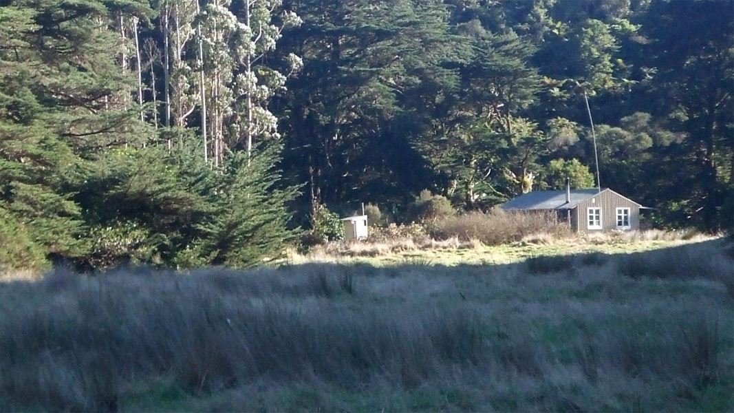
This is a standard 16-bunk hut in the Whareorino region.
On the way here
Mahoenui Track · 8 hr return
From Chris and Jan Barker's farm on Gribbon Road, this pleasant track follows the Awakino River upstream to Leitch's Hut.
Mangatoa Track · 8 hr return
From the car park, walk along the gradually climbing track until you reach the Herangi Ridge. The track veers right and drops down past the Waikawau Track junction before taking you to Leitch's Hut.
Waikawau Track · 14 hr
Follow the markers along the Waikawau and Mangapapa Rivers. This is a gradual climb with several river crossings. Continue up to the Waikawau Saddle and then descend to Leitch's Clearing. Follow the clearing down to the Awakino River, cross it and walk north along the river for 5 minutes to Leitch's Hut.
Source: DOC Te Papa Atawhai.
Fees and bookings
Before you go, buy Hut Tickets for each night's stay. Put these in the honesty box at the hut. Or buy a Backcountry Hut Pass that gives unlimited use at most Standard and Serviced huts for a 12 month period. Retailers that sell hut tickets and passes
Source: DOC Te Papa Atawhai.
On these tracks
Source: DOC Te Papa Atawhai.
Contact
DOC Customer Service Centre
Regional DOC service centre.
Notes from people who have been
No notes yet. If you have been, say what you found.
Something missing or out of date?
Closed, moved, wrong facts, or something we have missed? Travellers keep the Road Guide up to date. Tell us what you found at contribute@parkup.nz and we will check it and add it.
Ask us to take this down
A person reads every request. We do not remove a place until we have checked it.
Sources
- DOC Huts · CC BY 4.0Data sourced from the Department of Conservation (DOC), New Zealand.
- DOC Huts (API) · CC BY 4.0Crown Copyright: Department of Conservation Te Papa Atawhai. Data sourced from the DOC Developer Portal (api.doc.govt.nz).
- OpenStreetMap Huts · ODbL (Open Database License)Contains information from OpenStreetMap, made available under the ODbL.