Halfway Hut
HutCanterbury
Getting there
We have not checked a road end or car park for this place yet, so we do not give driving directions to it. Check how to get there before you go. Some routes cross private land and need the landowner's permission.
Map and tracks
Track lines: DOC Te Papa Atawhai. Map data © OpenStreetMap contributors. Topo map: LINZ, CC BY 4.0. 44.00693° S, 171.00053° E
Got a good photo of this place? Send it to us and we will show it with your name.
On the way here
Hope Kiwi Track · 18 hr 30 min
Hope Kiwi Lodge to Hope Halfway Hut
Time: 3 hr
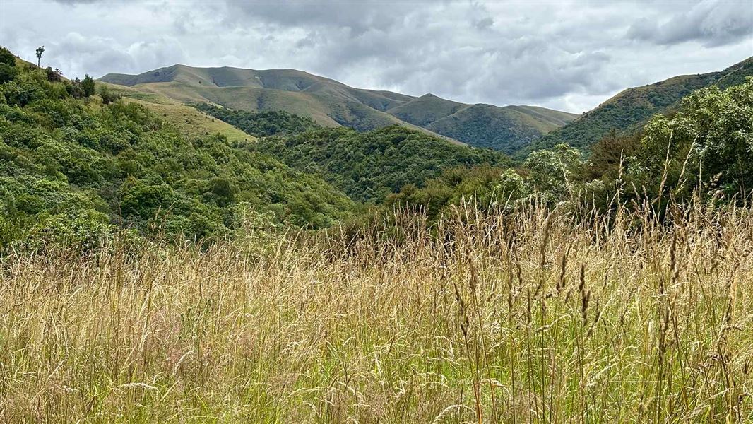
Follow the poled route from Hope Kiwi Lodge along the forest edge to the Hope River swingbridge about 30 minutes from the hut. The track follows down broad grassy flats before returning to the forest. The track leaves the river and climbs the bank to Hope Halfway Hut.
Hope Halfway Hut to Windy Point car park (SH7)
Time: 4 hr
The track keeps to the beech forest on terraces high above the riverbed. At the forest edge a vehicle track descends through mānuka and tussock to the swingbridge over the Boyle River gorge. Five minutes down a shingle road is the shelter and car park at Windy Point, beside SH 7. After crossing the swingbridge over the Boyle River, the first 500 m of track crosses through a public access easement over Poplars Station pastoral lease land before entering public conservation land. Keep to the track and do not disturb stock.
Windy Point car park to Hope Halfway Hut
Time: 4 hr
After crossing the swingbridge over Boyle River, follow a vehicle track that climbs through mānuka and tussock. At the forest edge, pick up the track across terraces high above the riverbed. It eventually drops to the Hope Halfway Hut.
Hope Halfway Hut to Hope Kiwi Lodge
Time: 3 hr
From the hut the track goes through beech forest to reach the valley floor. Follow the poled track up the valley floor to Hope River swingbridge. From here the hut is 30 minutes away, via a poled route across open terraces and through sections of forest to Hope Kiwi Lodge. From Hope Kiwi Lodge, you can access the Hope Pass Track.
Source: DOC Te Papa Atawhai.
We only have the basics for this place so far: its name, its type and where it is.
Been here? Tell us what you found at contribute@parkup.nz and we will add it.
Trip options
Walking times come from DOC track descriptions, added up leg by leg from car-accessible trailheads. Nights and return times are ParkUp estimates, allowing about 8 hours of walking a day.
2 options · 1 night
Hope Kiwi Lodge
Walking in
3 hr
Walking out
3 hr to Hope Kiwi Lodge
Walking in
3 hr
Walking out
7 hr to Hope Kiwi Lodge
Source: DOC Te Papa Atawhai track descriptions.
Nearby stops

Hope Kiwi Lodge
Serviced • 20 bunks • Canterbury • 181.8 km
Hope Kiwi Lodge is a serviced 20-bunk accommodation facility located in the North Canterbury and Arthur's Pass area. It provides basic lodging for travelers in…
Heating • Mattresses • Toilets - non-flush

Hope Halfway Hut
Basic/bivvies • 6 bunks • Canterbury • 187 km
Hope Halfway Hut is a basic six-bunk hut located in the North Canterbury and Arthur's Pass area.
Mattresses • Toilets - non-flush • Water from stream
Pleasant Gully Hut
Canterbury • 3.9 km
Devil's Creek Hut
Canterbury • 4.9 km
Devil's Creek Hut is a backcountry hut located in the Canterbury region of New Zealand. The provided records do not include specific details regarding its…
Te Moana Gorge Camp
Canterbury • 7.8 km
Notes from people who have been
No notes yet. If you have been, say what you found.
Something missing or out of date?
Closed, moved, wrong facts, or something we have missed? Travellers keep the Road Guide up to date. Tell us what you found at contribute@parkup.nz and we will check it and add it.
Ask us to take this down
A person reads every request. We do not remove a place until we have checked it.
Sources
- OpenStreetMap Huts · ODbL (Open Database License)Contains information from OpenStreetMap, made available under the ODbL.