Freshwater Landing to Mason Bay
WalkSouthland
- Grade
- Advanced
- Walking time
- 4 hr
- Distance
- 15.5 km
- Dogs
- No dogs
Getting there
We have not checked a road end or car park for this place yet, so we do not give driving directions to it. Check how to get there before you go. Some routes cross private land and need the landowner's permission.
How to get there, on doc.govt.nzThis track is part of the North West Circuit and Southern Circuit and it is accessible by walking adjoining tracks. The track between North Arm and Freshwater can be challenging, involving a significant river crossing, many steep and slippery gullies and knee-deep muddy sections.
The Freshwater Landing can be accessed by water taxi up the Freshwater River at high tide. Organise transport before you go as there is no reception once you head into the backcountry on Stewart Island.
Mason Bay beach can be accessed by plane or helicopter. You will need to contact the operators directly.
Visit the Stewart Island website to find out more about transport options to and from this track.
Tramping
This track is part of the North West Circuit and Southern Circuit and it is accessible by walking adjoining tracks. The track between North Arm and Freshwater can be challenging, involving a significant river crossing, many steep and slippery gullies and knee-deep muddy sections.
Transport
The Freshwater Landing can be accessed by water taxi up the Freshwater River at high tide. Organise transport before you go as there is no reception once you head into the backcountry on Stewart Island. Mason Bay beach can be accessed by plane or helicopter. You will need to contact the operators directly. Visit the Stewart Island website to find out more about transport options to and from this track.
Source: DOC Te Papa Atawhai.
Map
Map data © OpenStreetMap contributors. Topo map: LINZ, CC BY 4.0. 46.90497° S, 167.85041° E
About this place
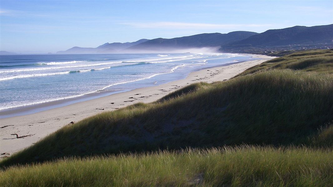
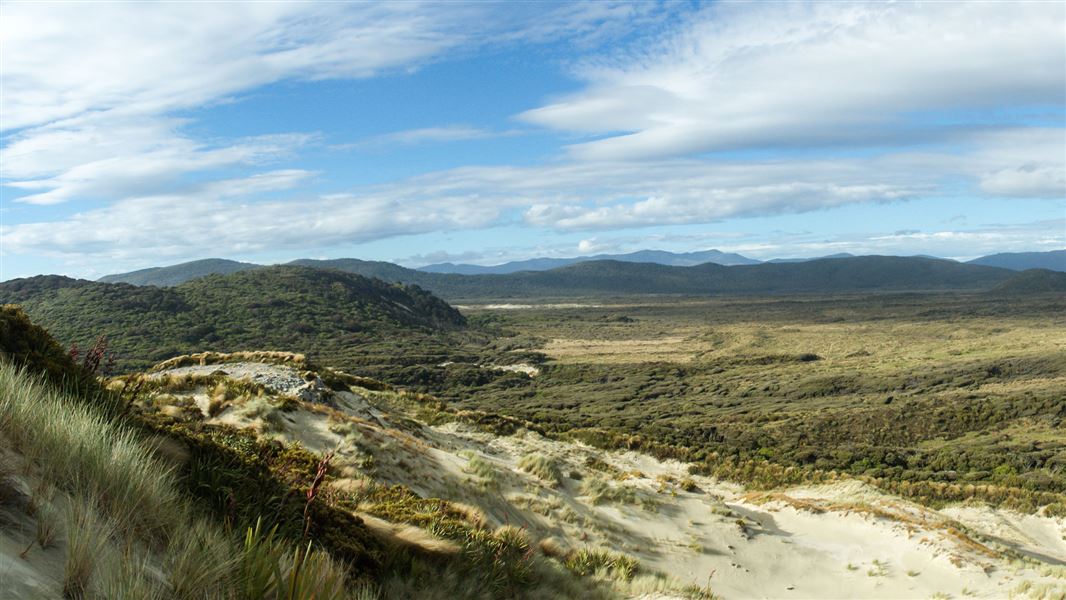
This is a backcountry walk over flat tussock wetland and mānuka country to Mason Bay which has one of the most extensive inland dune systems in the Southern Hemisphere.
The route
The track to Mason Bay begins at the Freshwater Landing near Freshwater Hut and heads inland directly through a tussock wetland. Freshwater Hut It is well marked and is easy to follow due to the mānuka shrubland that lines either side. In this area it is likely that you will see a wide variety of bird species such as bellbird/korimako, tomtit/miromiro and the Stewart Island Robin/toutouwai. After about 3 km, the mānuka shrubland becomes thicker and the track begins to follow the swiftly flowing Scott Burn Stream. During heavy rain, this 4 km section of the track is prone to flooding and at either end of this section there are flood signs with an orange marker located 20 cm above the base of the post. If the water is above the orange flood marker it is crucial that trampers do not proceed, as sections of this stream are prone to erosion and this will be not visible in flood waters. Instead, turn back and return the way you came. Leaving the mānuka shrubland behind, the track begins to open up and starts to follow a short boardwalk through a wetland area. Here you begin to get your first glimpses of the extensive sand dunes that Mason Bay is so well known for. Nearing Mason Bay, the track passes through old fences, areas of pasture and leads you to past historical relics such as the shearing shed and Island Hill Homestead. After passing the Homestead, Mason Bay Hut is located 15 minutes further down the track. Mason Bay Hut
Source: DOC Te Papa Atawhai.
Know before you go
What to take
Remember to pack everything in your pack inside a plastic pack liner to keep it dry, especially your sleeping bag and clothes. Bring at least an extra day’s food with you in case you are delayed (for example, by severe weather). Multi-day tramp gear list
Stay safe when crossing rivers and streams
If you plan to cross unbridged rivers or side streams, know how to cross safely and be prepared for if you cannot cross. Do not cross if the river or stream is flooded, you cannot find safe entry and exit points or are unsure it’s safe. Turn back or wait for the river to drop. If in doubt, stay out. How to cross rivers safely NIWA river flow forecasts: View a video of national followed by regional river flows
Source: DOC Te Papa Atawhai.
Nearby stops

Homestead Hunters Hut
Basic/bivvies • 4 bunks • Southland • 4.4 km
Homestead Hunters Hut is a basic four-bunk hut located in the Stewart Island/Rakiura area of Southland.
Heating • Mattresses • Toilets - non-flush

Mason Bay Hut
Standard • 20 bunks • Southland • 5.8 km
Mason Bay Hut is a standard 20-bunk hut located in the Stewart Island/Rakiura area of Southland.
Heating • Mattresses • Toilets - non-flush

Freshwater Hut
Standard • 16 bunks • Southland • 6.7 km
Freshwater Hut is a standard 16-bunk hut located in the Stewart Island/Rakiura area of Southland.
Heating • Mattresses • Toilets - flush

Martins Creek Hunters Hut
Basic/bivvies • 4 bunks • Southland • 7.8 km
Martins Creek Hunters Hut is a basic four-bunk hut located in the Stewart Island/Rakiura area of Southland.
Heating • Mattresses • Toilets - non-flush

Little Hellfire Hunters Hut
Basic/bivvies • 6 bunks • Southland • 8.6 km
Little Hellfire Hunters Hut is a basic six-bunk hut located in the Stewart Island/Rakiura area of Southland.
Heating • Mattresses • Toilets - non-flush
Notes from people who have been
No notes yet. If you have been, say what you found.
Something missing or out of date?
Closed, moved, wrong facts, or something we have missed? Travellers keep the Road Guide up to date. Tell us what you found at contribute@parkup.nz and we will check it and add it.
Ask us to take this down
A person reads every request. We do not remove a place until we have checked it.
Sources
- DOC Tracks (API) · CC BY 4.0Crown Copyright: Department of Conservation Te Papa Atawhai. Data sourced from the DOC Developer Portal (api.doc.govt.nz).