East Eglinton Track
WalkSouthland
- Grade
- Expert
- Walking time
- 2 hr
- Dogs
- No dogs
Getting there
We have not checked a road end or car park for this place yet, so we do not give driving directions to it. Check how to get there before you go. Some routes cross private land and need the landowner's permission.
How to get there, on doc.govt.nzThis route begins from the Milford Road, Fiordland, about 55 km north from Te Anau.
Near the East Eglinton road bridge, a sign on the roadside says ‘East Branch’ and marks the start of the route.
Source: DOC Te Papa Atawhai.
Map
Map data © OpenStreetMap contributors. Topo map: LINZ, CC BY 4.0. 45.05118° S, 168.03059° E
About this place
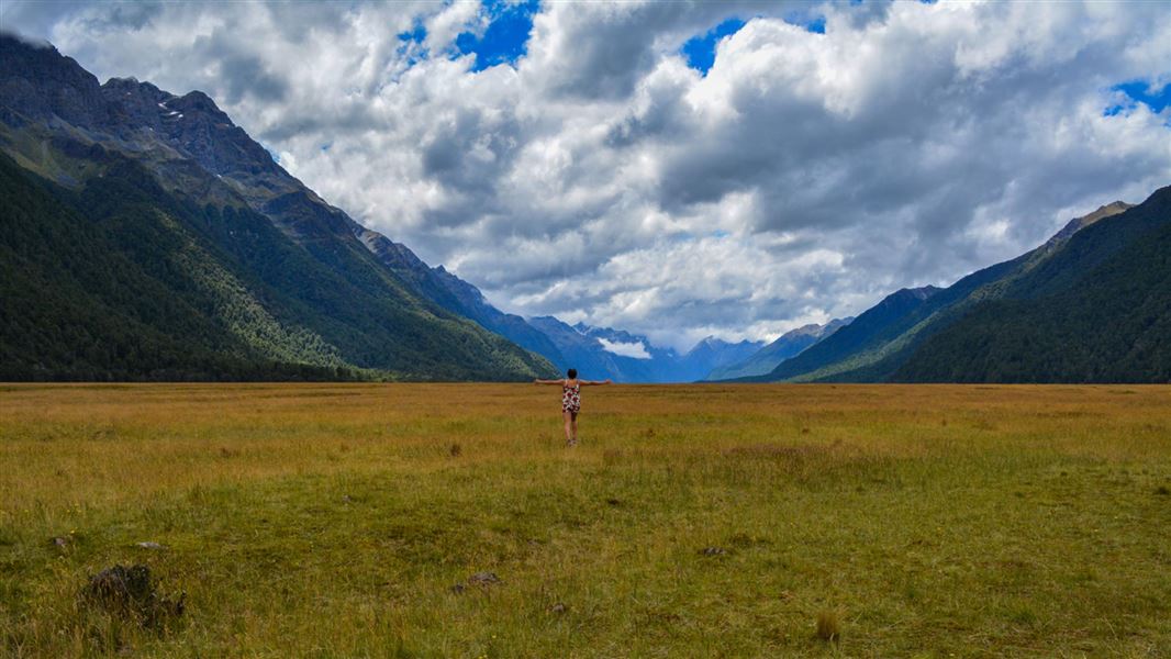
This challenging tramping route leads from the Milford Road, up the East Eglinton river valley through beech forest.
The route
This is a challenging tramping route. From the ‘East Branch’ sign on the Milford Road, the route heads up the true right river bank. After about 2 hours you reach the river forks, where the East Branch meets the Annear Creek. After this point the route crosses to the true left and continues to the flats in the upper valley (6 hours away) and beyond, for experienced trampers.
Source: DOC Te Papa Atawhai.
Nearby stops
Mackay Creek Campsite
Southland • 3.5 km
Mackay Creek Campsite is a quiet campsite in northern Fiordland, Southland, offering views of the Eglinton Valley. Visitors can fly fish in the river or…

Totara Campsite
Standard • Southland • 4.5 km
Totara Campsite is a scenic campsite in northern Fiordland, Southland. It offers sheltered sites within lush beech forest and is suitable for larger vehicles.
Fire pit/place for campfires (except in fire bans) • Non-powered/tent sites • Water from stream

Deer Flat Campsite
Standard • Southland • 6 km
Deer Flat Campsite is a standard campsite in northern Fiordland, situated beside the Eglinton River. The site features a grassy area surrounded by small…
Fire pit/place for campfires (except in fire bans) • Non-powered/tent sites • Water from stream

Walker Creek Campsite
Standard • Southland • 7.5 km
Walker Creek Campsite is a small, scenic campsite in northern Fiordland beside the Eglinton River.
Fire pit/place for campfires (except in fire bans) • Non-powered/tent sites • Water from stream

Kiosk Creek Campsite
Standard • Southland • 9.9 km
Kiosk Creek Campsite is a scenic campsite in northern Fiordland, Southland. It offers views of glacial moraine deposits.
Fire pit/place for campfires (except in fire bans) • Non-powered/tent sites • Toilets - non-flush
Walks nearby
Notes from people who have been
No notes yet. If you have been, say what you found.
Something missing or out of date?
Closed, moved, wrong facts, or something we have missed? Travellers keep the Road Guide up to date. Tell us what you found at contribute@parkup.nz and we will check it and add it.
Ask us to take this down
A person reads every request. We do not remove a place until we have checked it.
Sources
- DOC Tracks (API) · CC BY 4.0Crown Copyright: Department of Conservation Te Papa Atawhai. Data sourced from the DOC Developer Portal (api.doc.govt.nz).