Cable Bay Walkway
WalkNelsonOpen
- Grade
- Easy
- Walking time
- 3 hr 30 min
- Dogs
- No dogs
Getting there
We have not checked a road end or car park for this place yet, so we do not give driving directions to it. Check how to get there before you go. Some routes cross private land and need the landowner's permission.
How to get there, on doc.govt.nzBuses and other forms of public transport are common in the area but there are no scheduled services to this walk.
Glen end directions
Starting in Nelson head north east out of Nelson on SH6. After around 10 km turn left on Glen Road. This road becomes Seafield Terrace after around 2 km. Park your vehicle just before the turn off to Airlie Street. There’s no parking at the start of the track. The track starts around 550 metres up Airlie Street.
Rotokura/Cable Bay end directions
Starting in Nelson head north east out of Nelson on SH6. After around 13.7 km turn left onto Cable Bay Road. After around 8 km you’ll come to the track start – 821 Cable Bay Road. There’s parking at the start of this end of the track.
Source: DOC Te Papa Atawhai.
Map
Map data © OpenStreetMap contributors. Topo map: LINZ, CC BY 4.0. 41.17564° S, 173.38891° E
About this place
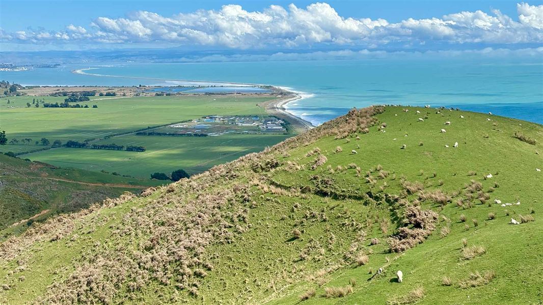
Enjoy the coastal views on this walkway between Rotokura/Cable Bay and The Glen, near Nelson. Boating, sea kayaking, and snorkeling are all possible.
The route
The complete walk takes about 3½ hours one way, and requires transport arrangements to be made. From the Rotokura/Cable Bay end a shorter return trip is to the top of the first hill (1 hr return) or to the forest edge (2 hr return). From the Glen end, a round trip to the airstrip and back takes about 2 hours. Cable Bay Walkway offers wonderful coastal views of the Boulder Bank, Nelson City and Kahurangi and Abel Tasman National Parks. The middle section of the track passes through a patch of beautiful and varied native forest. The track is a walking track. It is steep in places and strong footwear is recommended.
Source: DOC Te Papa Atawhai.
Nearby stops
Cable Bay Holiday Park
Nelson • 2.5 km
Maitai Valley Motor Camp
Nelson • 13.8 km
Free Self Contained Camping
Nelson • 13.9 km
Free Self Contained Camping is a campsite located in the Nelson region. The site is designated for self-contained vehicles, allowing visitors to stay without…
Nelson City Holiday Park
Nelson • 15.8 km
Nelson City Holiday Park is a campsite located in the Nelson region. It provides a place for visitors to stay while exploring the local area.
The Brook Valley Holiday Park
Nelson • 16.9 km
The Brook Valley Holiday Park is a campsite located in the Nelson region. No further details regarding facilities or amenities are available in the provided…
Notes from people who have been
No notes yet. If you have been, say what you found.
Something missing or out of date?
Closed, moved, wrong facts, or something we have missed? Travellers keep the Road Guide up to date. Tell us what you found at contribute@parkup.nz and we will check it and add it.
Ask us to take this down
A person reads every request. We do not remove a place until we have checked it.
Sources
- DOC Tracks (API) · CC BY 4.0Crown Copyright: Department of Conservation Te Papa Atawhai. Data sourced from the DOC Developer Portal (api.doc.govt.nz).
- DOC Tracks & Trails · CC BY 4.0Data sourced from the Department of Conservation (DOC), New Zealand.