Buckland Peaks Track
WalkWest Coast
- Grade
- Expert
- Walking time
- 11 hr
- Distance
- 11 km
- Dogs
- Not Applicable
Getting there
We have not checked a road end or car park for this place yet, so we do not give driving directions to it. Check how to get there before you go. Some routes cross private land and need the landowner's permission.
How to get there, on doc.govt.nzThe track starts at a car park 1.3 km down Bucklands Peak Road, which is 6.5 km south of Westport.
Source: DOC Te Papa Atawhai.
Map
Map data © OpenStreetMap contributors. Topo map: LINZ, CC BY 4.0. 41.86541° S, 171.61060° E
About this place
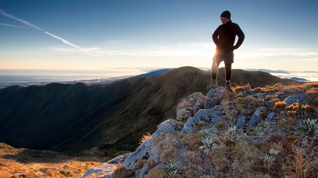
Walk through forest and subalpine scrub to Buckland Peaks for stunning views of the Paparoa Range.
The route
Car park to track head
Time: 1 hr
km Starting from the car park, the first hour of the track follows a locked four wheel drive track across Caroline Terrace. This part is walking access only – no vehicles including bikes allowed. Respect this easement.
Buckland Peaks Track to Buckland Peak Hut
Time: 4 hr
4.53 km This tramping track starts in regenerating cutover forest. You quickly reach diverse podocarp beech forest, climbing relatively steeply from 200 m to 1,100 m. There is a clearing marked as Halfway House which can be good for a rest stop. Mixed podocarp forest changes to dracophyllum to subalpine scrub as you reach the tussock tops. Here you will see Buckland Peaks Hut in the basin about 100 m below the track. If continuing onto the peaks you do not need to drop to the hut.
Buckland Peaks Hut to Buckland Peaks (unmarked route)
Time: 1 hour
From the hut follow the markers back up to the top of the basin. There is no track beyond this point. The unmarked route drops down from point 1175 and continues towards the true peak. Cloud can appear suddenly at any time and vastly decrease visibility. Route finding skills are essential. The Buckland Peaks have amazing granite boulders and formations as well as a large diversity of alpine flora. Here you have stunning views of the rugged Paparoa Range.
Source: DOC Te Papa Atawhai.

Nearby stops
Jack's Gasthof
West Coast • 11.4 km
Jack's Gasthof is a campsite located in the West Coast region of New Zealand. No further details regarding facilities or specific amenities are available in…
Westport Kiwi Holiday Park
West Coast • 12.6 km
Seal Colony Top 10 Holiday Park
West Coast • 13.6 km
Kawatiri Beach Reserve
West Coast • 14.6 km
Kawatiri Beach Reserve is in Westport, within Buller River Mouth Conservation Area. Certified self-contained vehicles may stay up to four nights in one…
Charleston Motor Camp
West Coast • 15 km
Notes from people who have been
No notes yet. If you have been, say what you found.
Something missing or out of date?
Closed, moved, wrong facts, or something we have missed? Travellers keep the Road Guide up to date. Tell us what you found at contribute@parkup.nz and we will check it and add it.
Ask us to take this down
A person reads every request. We do not remove a place until we have checked it.
Sources
- DOC Tracks (API) · CC BY 4.0Crown Copyright: Department of Conservation Te Papa Atawhai. Data sourced from the DOC Developer Portal (api.doc.govt.nz).