Blue Lake Hut
Serviced hutNelson Lakes National Park, TasmanOpen
- Sleeps
- 16 bunks
- Booking
- Can book
- Cost
- from $25
- Heating
- Yes
- Drinking water
- Boil first
- Toilet
- Non-flush
Getting there
We have not checked a road end or car park for this place yet, so we do not give driving directions to it. Check how to get there before you go. Some routes cross private land and need the landowner's permission.
How to get there, on doc.govt.nzBlue Lake is not accessible by car or on a day walk.
The lake is located deep in the backcountry and it takes a minimum of two days backcountry tramping to visit it.
To access the lake the shortest way, take the water taxi from Lake Rotoroa Jetty to Sabine Hut. Walk from:
If you wish to access Blue Lake from St Arnaud, plan a minimum of four days return.
- Topo map
- Topo50 sheet BS24
- Grid reference
- E1571514, N5343732
Source: DOC Te Papa Atawhai.
Map and tracks
Track lines: DOC Te Papa Atawhai. Map data © OpenStreetMap contributors. Topo map: LINZ, CC BY 4.0. 42.05795° S, 172.65573° E
About this place
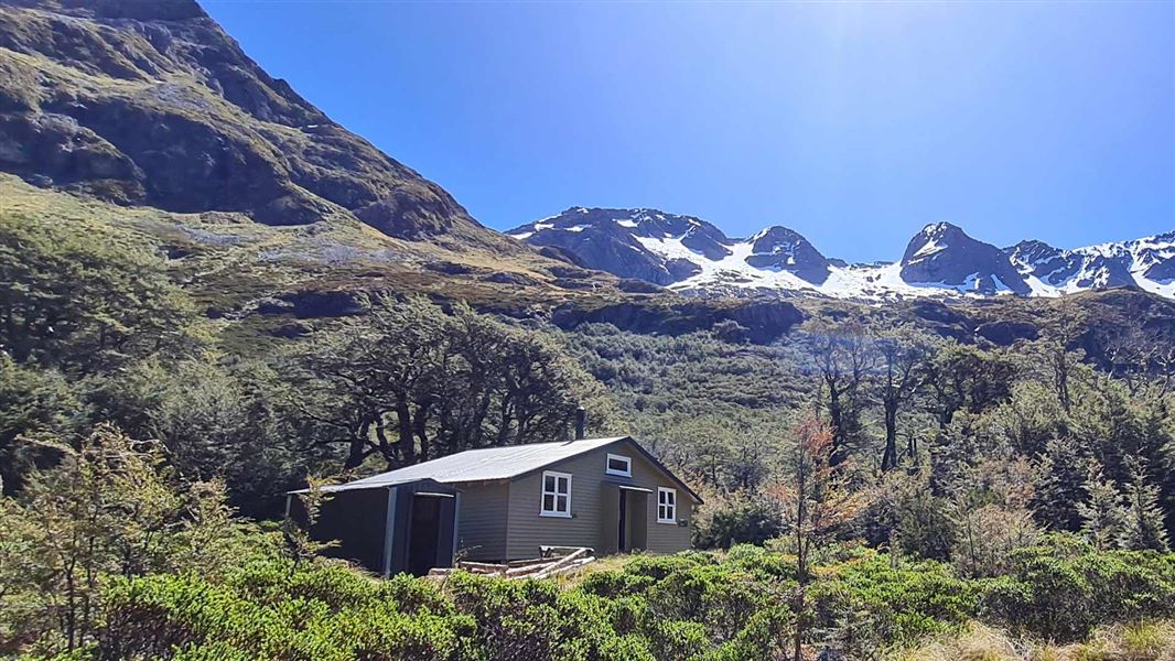
This is a serviced 16-bunk hut in the Nelson Lakes area.
On the way here
Waiau Pass Route (Blue Lake Route to Lewis Pass) · 8-10 days for full trip
Blue Lake Hut to Waiau Hut
Time: 9-12 hr
Assess the weather before starting the ascent over Waiau Pass. Only attempt the pass in good weather – if the weather is bad, we recommend waiting in Blue Lake Hut and trying the pass another day. Start early, as you should allow 9-12 hr to cross the pass and reach Waiau Hut.
Blue Lake Hut to top of Waiau Pass
From Blue Lake Hut follow the signs, orange triangle makers and orange poled route which lead you south. The route climbs the moraine which is damming Rotopohueroa/Lake Constance. Once on top of the moraine, follow the marker poles which lead high above the cliffs on the western side of the lake. Do not follow the lake edge – you will eventually get stopped by impassable bluffs and deep water and have to turn back. The route around the cliffs above Rotopohueroa/Lake Constance will lead you through some steep guts and spurs. It then drops back down to the lake edge (approximately 2.7km from the hut) and follows the shoreline to the lakehead. Waiau Pass Route leads high above the cliffs on the western side of the lake Image: DOC At the lake’s northern end, follow the route along the valley floor for approximately 1km, with several stream crossings. The route then turns to the left (south) and starts to climb scree and steep rocky sections to Waiau Pass. It is approximately 1.5 km from the valley floor to the saddle and you gain 530 m in altitude. Hard icy snow can remain until December in these last 150+ metres of elevation, which can be very difficult to negotiate if the conditions are unfavourable.
Top of Waiau Pass to Upper Waiau Forks
Be aware that this section from the top of the pass to the valley floor is very steep and technical, even on a good day. There are many places where it is possible to slip or get stuck, particularly when there is snow and ice. From the top of the pass, assess the conditions on the south side of the pass. Snow can be present at any time of the year – if there is snow, then do not proceed unless you have an ice axe, crampons and avalanche rescue equipment (and know how to use them). Return to Blue Lake Hut instead. Follow the orange markers down from the Waiau Pass summit, ensuring you stay on the marked route. The route leads to the right from the summit, rather than descending directly into the valley. The descent is steep and rocky, so take your time and watch your footing. Waiau Pass Route leads to the right from the summit Image: DOC When you reach the valley, the route leads down the west branch of the Waiau Uwha River. It descends through scrub, then crosses the east branch of the river not far above the forks.
Travers-Sabine Circuit · 4 - 7 days
Rotomairewhenua/Blue Lake, 7 hr return
This is a worthwhile overnight side‑trip from the main circuit. Head upstream from the West Branch Sabine swing bridge. After 1 hr 30 min, the valley broadens and the track passes through forest destroyed by an avalanche in 1980. Climb steeply in two stages to a high basin containing Blue Lake Hut. Rotomairewhenua/Blue Lake is thought to be the clearest natural freshwater lake in the world. Please respect this pristine water by refraining from washing or swimming in the lake.
St Arnaud to Boyle Te Araroa Route · 8-9 days
West Sabine Hut to Blue Lake Hut
Time: 3 hr
7.7 km Head upstream from the West Branch Sabine swing bridge. After 1 hr 30 min, the valley broadens and the track passes through forest destroyed by an avalanche in 1980. Climb steeply in two stages to a high basin containing Blue Lake Hut. Rotomairewhenua/Blue Lake is thought to be the clearest natural freshwater lake in the world. The lake is sacred to iwi and at significant risk from aquatic biosecurity threats. Please respect this pristine water by refraining from washing, swimming or touching the waters in the lake. Camping is not allowed close to the lake. This section of track crosses several avalanche zones where avalanches commonly run to valley floor in spring.
Blue Lake Hut to Waiau Hut
Time: 9-12 hr
Assess the weather before starting the ascent over Waiau Pass. Only attempt the pass in good weather – if the weather is bad or the pass is in cloud, we recommend waiting in Blue Lake Hut and trying the pass another day. Start early, as you should allow 9-12 hr to cross the pass and reach Waiau Hut. There is also a campsite (no toilet) available at Waiau Forks. Watch a Mountain Safety Council video guide to the route over Waiau Pass:
Blue Lake Hut to top of Waiau Pass
From Blue Lake Hut follow the signs, orange triangle makers and orange poled route which lead you south. The route climbs the moraine which is damming Rotopohueroa/Lake Constance. Once on top of the moraine, follow the marker poles which lead high above the cliffs on the western side of the lake. Do not follow the lake edge – you will eventually get stopped by impassable bluffs and deep water and have to turn back. The route around the cliffs above Rotopohueroa/Lake Constance will lead you through some steep guts and spurs. It then drops back down to the lake edge (approximately 2.7 km from the hut) and follows the shoreline to the lakehead. Waiau Pass Route leads high above the cliffs on the western side of the lake. Image: DOC At the lake’s northern end, follow the route along the valley floor for approximately 1km, with several stream crossings. The route then turns to the left (south) and starts to climb scree and steep rocky sections to Waiau Pass. It is approximately 1.5 km from the valley floor to the pass and you gain 530 m in altitude. Hard icy snow can remain until December in these last 150+ metres of elevation, which can be very difficult to negotiate if the conditions are unfavourable.
Top of Waiau Pass to Upper Waiau Forks
Be aware that this section from the top of the pass to the valley floor is very steep and technical, even on a good day. There are many places where it is possible to slip or get stuck, particularly when there is snow and ice. From the top of the pass, assess the conditions on the south side of the pass. Snow can be present at any time of the year – if there is snow, then do not proceed unless you have an ice axe, crampons and avalanche rescue equipment (and know how to use them). Return to Blue Lake Hut instead. Follow the orange markers down from the Waiau Pass summit, ensuring you stay on the marked route. The route leads to the right from the summit, rather than descending directly into the valley. The descent is steep and rocky, so take your time and watch your footing. Waiau Pass Route leads to the right from the summit. Image: DOC When you reach the valley, the route leads down the west branch of the Waiau Uwha River. It descends through scrub, then crosses the east branch of the river not far above the forks.
Source: DOC Te Papa Atawhai.
Know before you go
Respect the pure lake water by not touching it
Rotomairewhenua/Blue Lake and Rotopōhueroa/Lake Constance hold high cultural significance to Māori, particularly Ngāti Apa ki te Rā Tō iwi. The lakes are tapu (sacred) and restrictions are placed on these lakes to uphold their mauri (life force) and purity. Show respect by not touching the water. Do not swim, wash, take water or put any equipment into these lakes.
Keep lakes free of lindavia (lake snow)
The invasive alga lindavia is present in Lakes Rotoiti and Rotoroa. It causes lake snow – a sticky mucus that hangs below the surface of the water. U se a biosecurity cleaning station at Coldwater Hut, Lakehead Hut and Sabine Hut to disinfect any boots, socks, clothing, towels or drink bottles that are wet or damp from lake or river water. Do not touch the water in Rotomairewhenua/Blue Lake and Rotopōhueroa/Lake Constance. You may swim and fill drink bottles in the Sabine River below the outlet of Rotomairewhenua/Blue Lake. Find out more on how to stop the spread
Source: DOC Te Papa Atawhai.
Trip options
Walking times come from DOC track descriptions, added up leg by leg from car-accessible trailheads. Nights and return times are ParkUp estimates, allowing about 8 hours of walking a day.
2 options · 3 to 6 nights
St Arnaud
Walking in
22 hr 30 min (via Lakehead Hut/Coldwater Hut, John Tait Hut, Upper Travers Hut, West Sabine Hut)
Walking out
22 hr 30 min to St Arnaud (via Lakehead Hut/Coldwater Hut, John Tait Hut, Upper Travers Hut, West Sabine Hut)
Walking in
22 hr 30 min (via Lakehead Hut/Coldwater Hut, John Tait Hut, Upper Travers Hut, West Sabine Hut)
Walking out
25 hr to Boyle settlement (via Waiau Hut, Anne Hut)
Source: DOC Te Papa Atawhai track descriptions.
Fees and bookings
1 May - 30 September
1 October - 30 April
Weekdays
Weekends
1 December - 29 February
Weekdays
Weekends
Backcountry Hut Passes Passes are valid for use in this hut from 1 May to 30 September. Passes Before you go, buy Hut Tickets for each night's stay. Put this in the honesty box at the hut. Or buy a Backcountry Hut Pass or Campsite Pass. About hut tickets and passes About campsite passes Retailers that sell hut tickets and passes Te Araroa – The Trail Pass Te Araroa Trail Pass
Bookings are open for stays up to 30 June 2027. If no availability shows online for your dates, the hut is fully booked. No spaces are kept for visitors arriving without a booking. Phone and in‑person bookings made at a visitor centre incur a $10 service fee. Same‑day bookings are available online until 8 pm if spaces remain. Book Blue Lake Hut online
Source: DOC Te Papa Atawhai.
On these tracks
Source: DOC Te Papa Atawhai.
Nearby stops
Upper Travers Hut
Serviced • 24 bunks • Tasman • 8.8 km
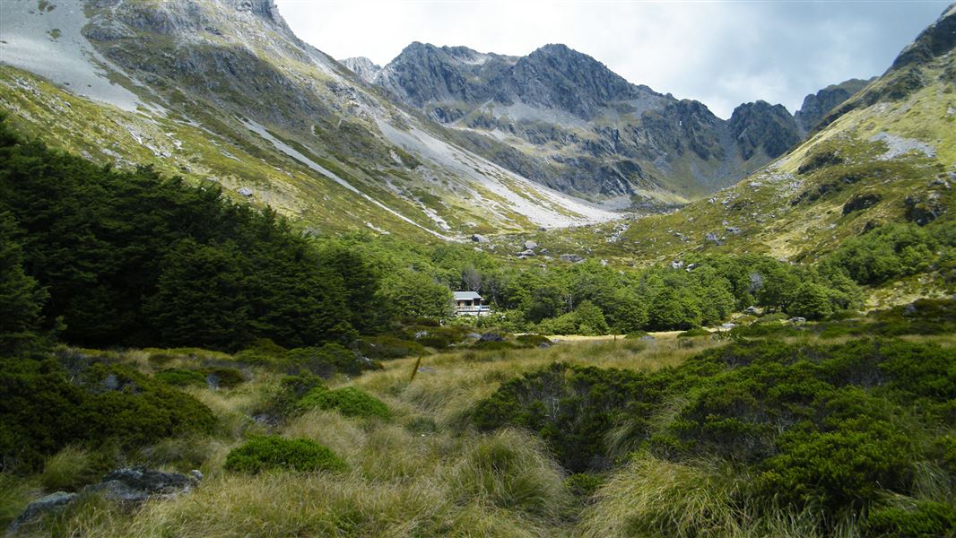
Upper Travers Hut is a serviced 24-bunk hut located in the Nelson Lakes area of the Tasman region.
Heating • Mattresses • Toilets - non-flush
John Tait Hut
Serviced • 25 bunks • Tasman • 13.1 km
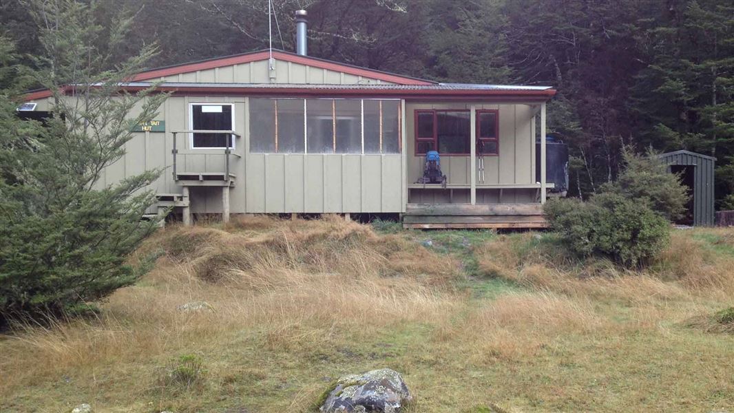
John Tait Hut is a serviced 25-bunk hut located in the Nelson Lakes area.
Heating • Mattresses • Toilets - non-flush
Sabine Hut
Serviced • 32 bunks • Tasman • 17.5 km
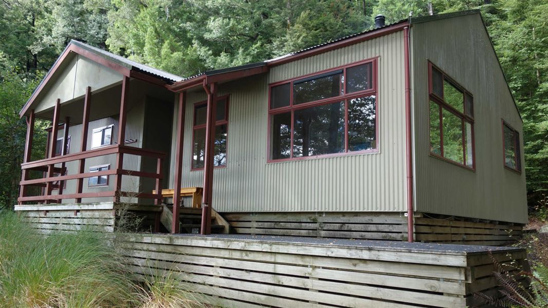
Sabine Hut is a serviced 32-bunk hut located in the Nelson Lakes area of the Tasman region.
Heating • Mattresses • Toilets - non-flush

Coldwater Hut
Standard • 12 bunks • Tasman • 24.8 km
Coldwater Hut is a Department of Conservation hut in the Tasman region that offers a suitable overnight tramp for families with children and those new to…
Heating • Mattresses • Toilets - non-flush
Central Waiau Hut
Hawke's Bay • 509.5 km
Heating • Mattresses • Toilets - non-flush
Contact
Nelson Lakes National Park Visitor Centre
Regional DOC service centre.
Notes from people who have been
No notes yet. If you have been, say what you found.
Something missing or out of date?
Closed, moved, wrong facts, or something we have missed? Travellers keep the Road Guide up to date. Tell us what you found at contribute@parkup.nz and we will check it and add it.
Ask us to take this down
A person reads every request. We do not remove a place until we have checked it.
Sources
- OpenStreetMap Huts · ODbL (Open Database License)Contains information from OpenStreetMap, made available under the ODbL.
- DOC Huts (API) · CC BY 4.0Crown Copyright: Department of Conservation Te Papa Atawhai. Data sourced from the DOC Developer Portal (api.doc.govt.nz).
- DOC Huts · CC BY 4.0Data sourced from the Department of Conservation (DOC), New Zealand.